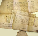
Searchable data plus 1.2 million images for 217,460 land grants issued in North Carolina from 1663 to 1960
|
- Learn how to plat metes and bounds! Website creator David McCorkle will teach a hands-on metes and bounds workshop at the NCGS conference in Raleigh!
-
Come hear and meet the folks behind this site at the NC Genealogical Society Conference Oct 25-26
in Raleigh or online!
- NC Land Grants wins multiple awards at the National Genealogical Society Conference Click for details (10 June 23).
- 1.2 million images now online Click for details (6 Mar 23).
- 1,434 previously missing land grants now online and searchable, includes 40% of all grants prior to 1730! Click for details. (12 Jan 22)
- Click here for more news: Another 150,000 images; Thanks (over half) a Million; Q&A from NGS presentation; Latest enhancements; ...
* Searchable data for 217,460 land grants including names, dates and locations for years 1663 through 1960, including 10,000 grants in what is now Tennessee
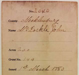
* 51,500 Images of all 200+ existing Land Patent Books with complete metes and bounds for each patent (Unique to this website!)
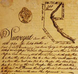
* 1,054,000 Images of loose documents (surveys, warrants, receipts) for 88 NC and 18 TN counties, with more on the way
* 41,000 Images of all Lord Granville Grants including signed deeds, warrants, and surveys (Unique to this website!)
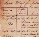
* 6,300 Images of all Land Grant Entry Books copied by the state 1778 - 1795 (Unique to this website!)
* 1,400 records of pre-1730 land grants not found in any other online databases (Unique to this website!)
SEARCH
INDEX
Find land grant files using a subject index.
QUERY
Find land grant files based on criteria such as name, location, acres, dates, etc.
BOOKS
View Patent Books by book and page number.
IMAGES ONLY
Browse land grant file images as copied from microfilm. It's like using a microfilm reader but much faster.
SITE
SIGN ON
Sign on or register (optional).
ABOUT
Information about this site.
HOW YOU CAN HELP
Information on how you can help me improve this site and keep it free for everyone.
LEARN
GETTING STARTED
Provides basic information on how to use this website to find land grant files.
FAQS
Frequently Asked Questions about this site and its contents.
RESOURCES
Other resources related to North Carolina land grants.
GLOSSARY
Glossary of land grant terms.
TOOLS
COUNTIES
Basic information about each county.
CALCULATOR
Convert ancient measurments such as rods and poles to modern.
METES & BOUNDS
Experimental metes & bounds drawing tool.
This website is owned and operated by NC Historical Records Online. The land grant images and associated data on this website were provided courtesy of the State Archives of North Carolina, Raleigh NC and are in the public domain. If you use this information elsewhere, please credit the State Archives of North Carolina as the source, along with the corresponding call number.
Content on this website not originating from the State Archives of North Carolina is Copyright 2014-2023 by NC Historical Records Online